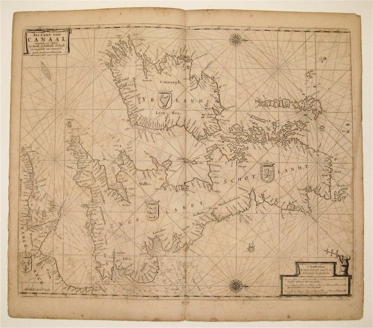
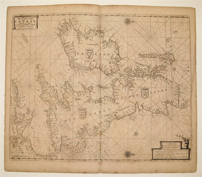
Pas-Caart vant Canaal Vertoonende in 't Gheheel Engelandt, Schotlandt, Yrlandt, en een Gedeelte van Vrancryck
Amsterdam: 1669.
Map. Uncolored copperplate engraving. Image measures 17.5 x 21.5".
This sea chart depicts the British aisles with North oriented to the right. Centered on the Isle of Man, each countries coat of arms is included. Soundings, sand bars, fishing banks and navigational hazards are noted. The cross-staff is being used in the scale cartouche. It was a navigational tool used to measure the angle between the horizon and a celestial body such as the sun or stars. This map was published in Goos' "De Zee-Atlas Ofte Water-Weereld" and remains in its original uncolored state, which allows Goos' intricate line work to shine. It is in good condition with foxing, soiling, and off-setting, and small mis-fold lower center. Pieter Goos (1616-1675) was a Dutch cartographer, engraver, publisher, printer, and print-seller based in Amsterdam. He belonged to a noted family of cartographers, headed by his father Abraham, who prepared plates for many maps published in the important atlases of the time. His pilot guide, the "Zee-Spiegel," provided some of the first charts of newly explored regions in the West Indies and Western Africa, and his "Zee-Atlas" is considered one of the best sea atlases of its time. This map is a fine example of Goos' high quality, visually appealing sea charts. State 8 of 10 as indicated by the matching dates.
Binding: Unbound
Language: English
Price: $1,200.00
Item #234100