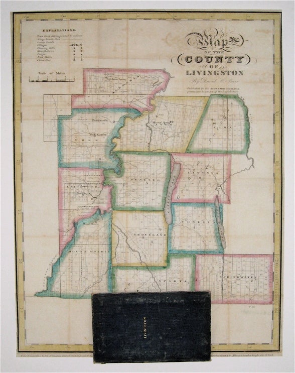
Map of the County of Livingston
New York: David Burr, 1829.
Pocket map. Copper plate engraving with original hand-coloring. Map attached to blue leather binding as issued, title stamped in gold. Image measures 15 1/2 x 12".
This rare fold-out pocket map depicts Livingston County in the Finger Lakes region of New York, divided into 12 towns outlined in vivid color. The map is centered around the town of Geneseo and denotes major routes, waterways, and topographical details. Icons label villages, flouring mills, factories, forges, saw mills, and churches. The map is in excellent condition with no tears of any kind. Some scattered staining, especially along original folds. It is attached to its original leather cover, and the watermark of the paper is visible. David H. Burr (1803-1875) served as Topographer to the United States Post Office and Geographer to the House of Representatives and was widely known for his accuracy and attention to detail. Burr was one of the first cartographers to map each of the United States individually. Issued separately rather than included in his seminal "Universal Atlas," this pocket map is a scarce version of Burr's celebrated work.
Binding: Unbound
Edition: First
Language: English
Price: $700.00
Item #233726