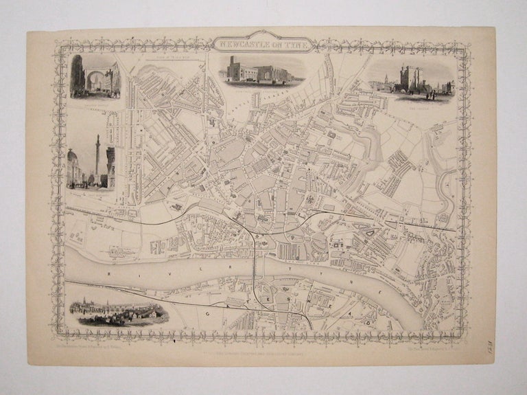
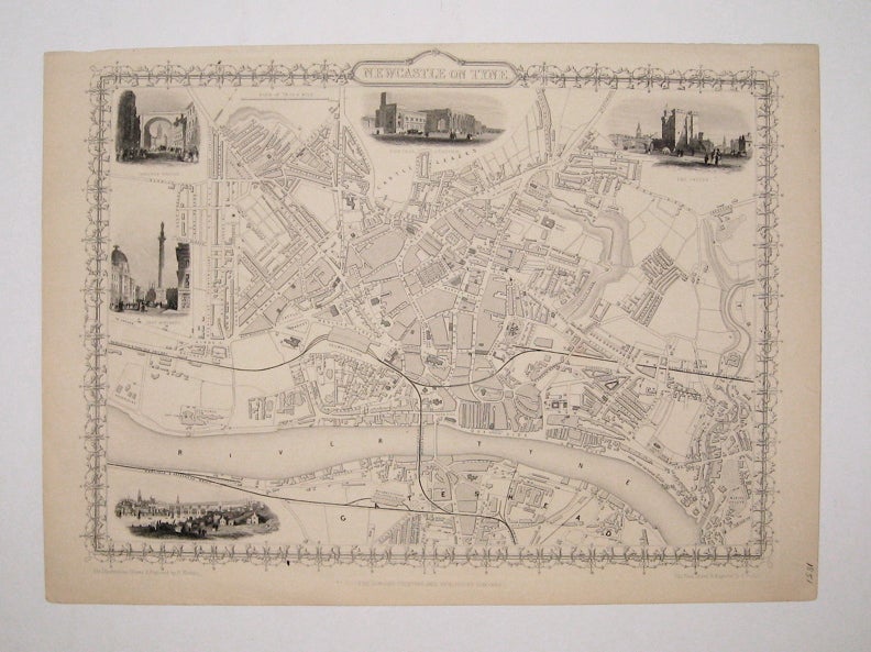
Newcastle on Tyne
London: Tallis, John, 1851.
Map. Steel engraving. Image measures 9 3/4" x 13 1/4".
Lovely town plan of Newcastle on Tyne in Northeast England, with the River Tyne running along the bottom edge. Includes districts, Railroads, and canals and five vignettes of notable buildings. No stains or chips usually seen in the Tallis series. The top margin, however, is closely cropped. John Tallis Jr. (1817-1876) was a London born bookseller who continued the prolific map publishing company started by his father. After a partnership with his brother, Tallis Jr. expanded the business to New York in 1849 as well as Boston, Cincinnati, Rochester, Philadelphia and Baltimore. This well known series of eighty maps was published in "Tallis's illustrated atlas and modern history of the world". This map is from the rare supplementary town plan series.
Illustrator: Rapkin, J.
Binding: Unbound
Language: English
Price: $300.00
Item #232942