
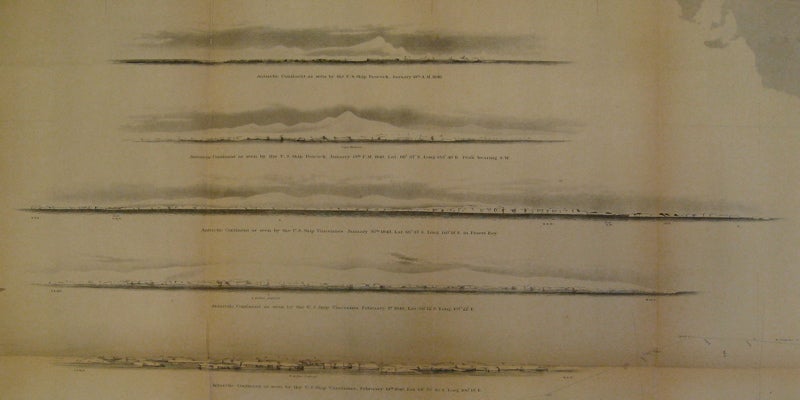


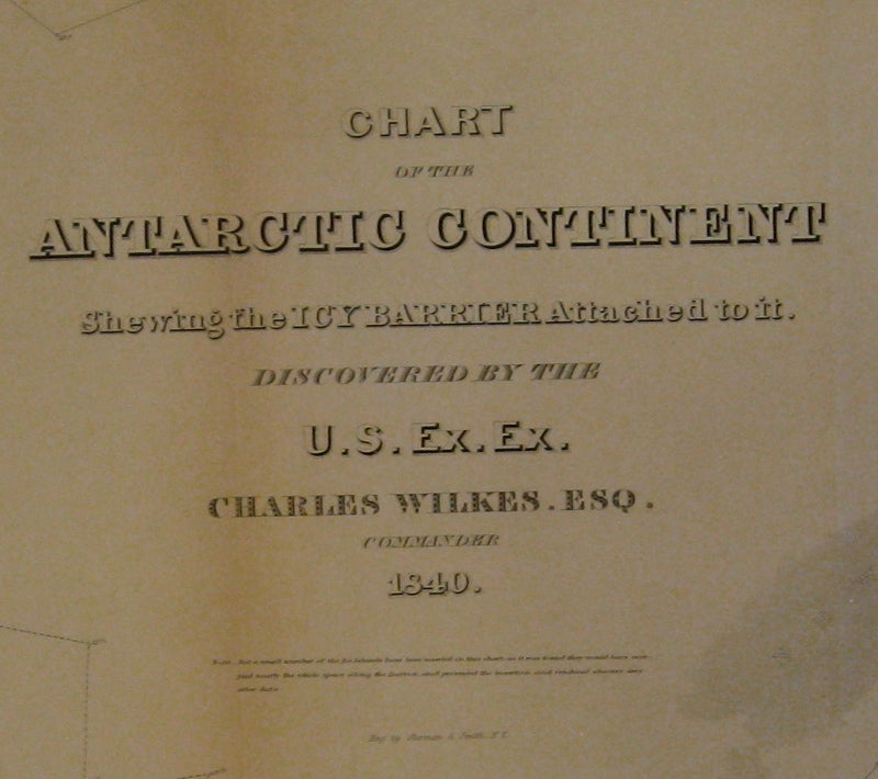
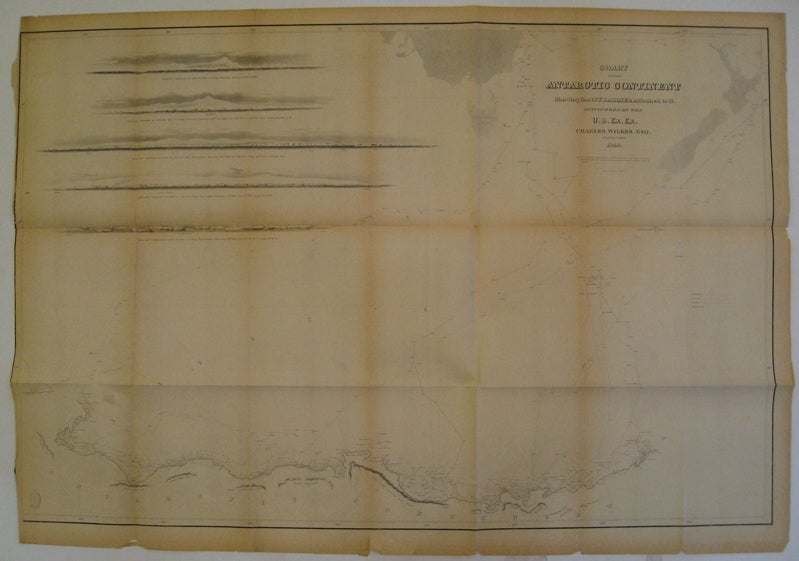
Chart of the Antarctic Continent Shewing the Icy Barrier Attached to it.
Philadelphia: Lea & Blanchard, 1845.
Sea chart. Uncolored lithograph. Image measures 23" x 35".
Rare sea chart showing the northern coast of Antarctica. Includes 5 profile views and the paths of four of his ships, the Vincennes, the Peacock, the Porpoise and the Flying Fish. This chart was published in Wilkes' "Narrative of the United States Exploring Expedition During the Years 1838, 1839, 1840, 1841, 1842" (1845), which describes his explorations and cultural encounters in mapping the South Seas, the American west, parts of South America, the East Indies and Antarctica. Charles Wilkes (1798-1877) was an impressively successful American explorer. Folding map in 21 sections. Chipping and minor tears to edges. Toning along all folds. Left margin cropped.
Binding: Unbound
Condition: Very Good(-)
Language: English
Price: $700.00
Item #219387