
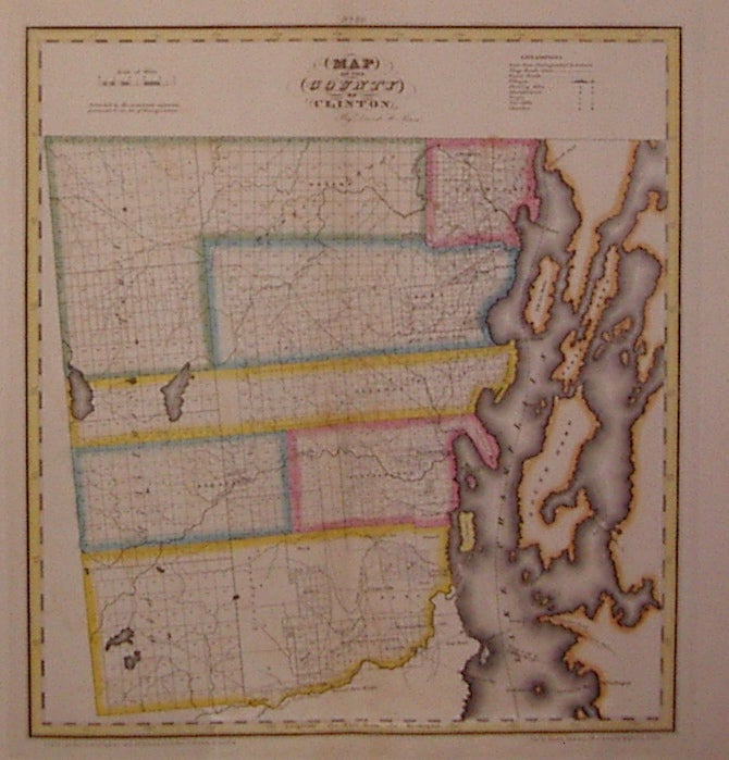
Map of the County of Clinton
New York: DeWitt, Simeon, 1829.
Map. Copper plate engraving with original hand coloring. Image measures 18.5" x 17".
Nice map of Clinton County in northern New York. Denotes townships, major routes, waterways and towns. In excellent condition with some wear to corners. David H. Burr (1803-1875) served as Topographer to the United States Post Office and Geographer to the House of Representatives and was widely known for his accuracy and attention to detail. This atlas was among the first to map each of the United States individually. Included is a separate page with statistical information and a historical description of Clinton County. Please visit our Gallery for more Burr New York county maps.
Illustrator: Rawdon Clark & Co.
Binding: Unbound
Condition: Very Good(+)
Language: English
Price: $175.00
Item #203497