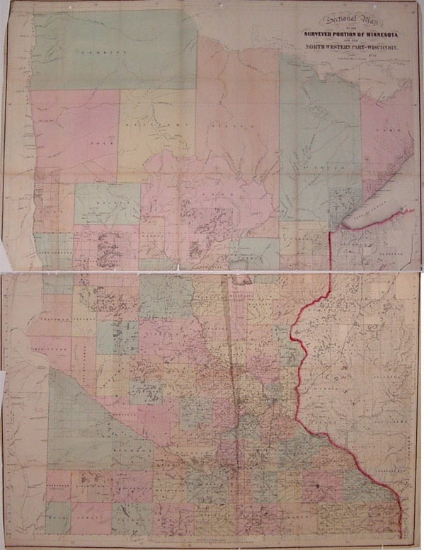
Sectional Map of the Surveyed Portion of Minnesota and the North Western Part of Wisconsin
Boston: J.S. Sewall, 1866.
Case map. Engraving with original hand coloring. Image measures 32.5" x 24.5".
Fantastic and rare map of Minnesota and part of Wisconsin divided into counties. Shows many townships, cities, major routes, waterways and Indian reservations. Originally a pocket map, now in two pieces with several repairs along folds. Creases and scattered chips, a few ink notations and light scattered foxing. Three holes along top from binding. Booklet is missing.
Illustrator: Swett, C.A.
Binding: Unbound
Condition: Very Good(-)
Language: English
Price: $500.00
Item #203217
See all items by J. S. SEWALL