
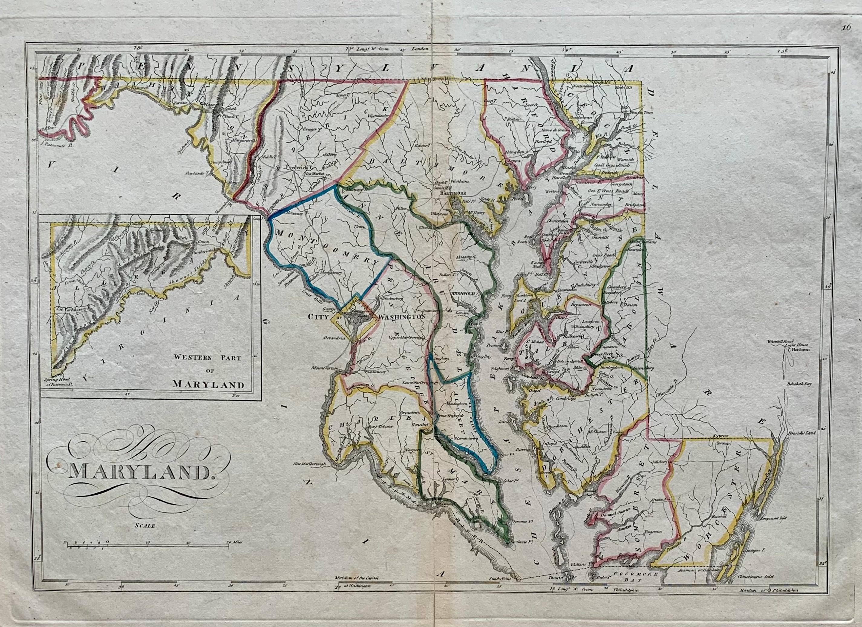
Maryland.
Philadelphia: Carey, Mathew, 1818.
Map. Engraving with original hand coloring. Image measures 11.25" x 16.5".
Beautiful early map of Maryland divided into counties including Washington DC. Shows towns, major routes and waterways. An inset shows "Western Part of Maryland". Expert reinforcement to centerfold and slight creases at lower left and right corners. A few scattered chips. Full original margins.
Mathew Carey (1760-1839) was an Irish-born American publisher, bookseller, and economist, as well as one the most important figures of early American cartography. Carey was based in Philadelphia, where he apprenticed for Benjamin Franklin before establishing his own book shop and publishing firm. He is credited with publishing the first American atlases, producing some of the best quality maps and most informative depictions of the United States in the early period after it gained independence.
Binding: Unbound
Condition: Very Good(+)
Language: English
Price: $700.00
Item #203016