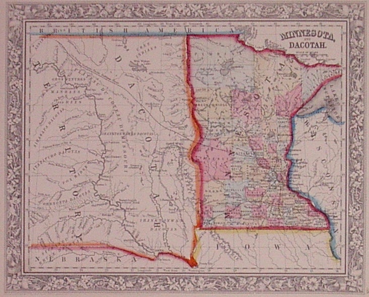
Minnesota, and Dacotah.
Philadelphia: Mitchell, Samuel Augustus Jr., 1862.
Map. Engraving with original hand coloring. Image measures 10.75" x 13.25".
Nice map of Minnesota and the eastern portion of the Dakotas showing towns, major routes, railroads and waterways. Minnesota is divided into counties and the Dakotas are shown as Dacotah Territory. Minor stains to margins, small chip to lower left corner.
Samuel Augustus Mitchell Sr. (1792-1868) was one of the leaders in American cartography of the 19th century and pioneered the conversion of engraved map plates to more affordable lithographic plates. His son, Samuel Augustus Mitchell Jr. continued his father's successful mapmaking and publishing business, and was one of the most prolific and renowned 19th century American publishers.
Binding: Unbound
Condition: Very Good(+)
Language: English
Price: $150.00
Item #202904