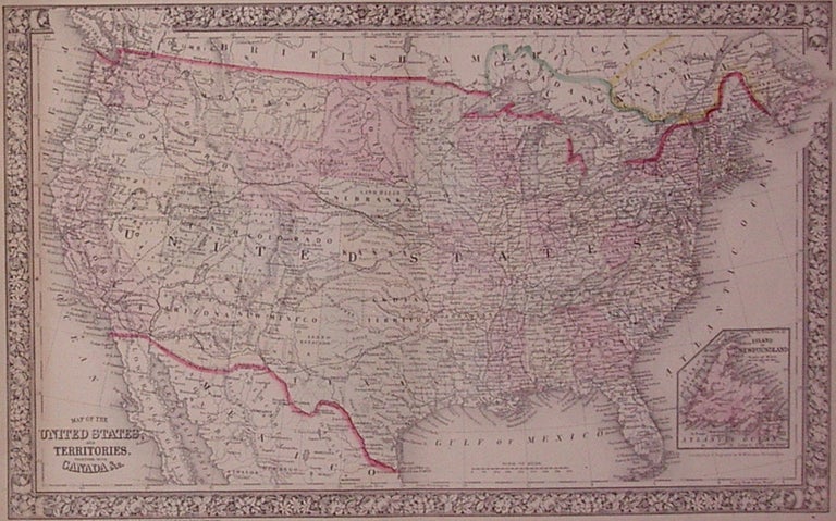
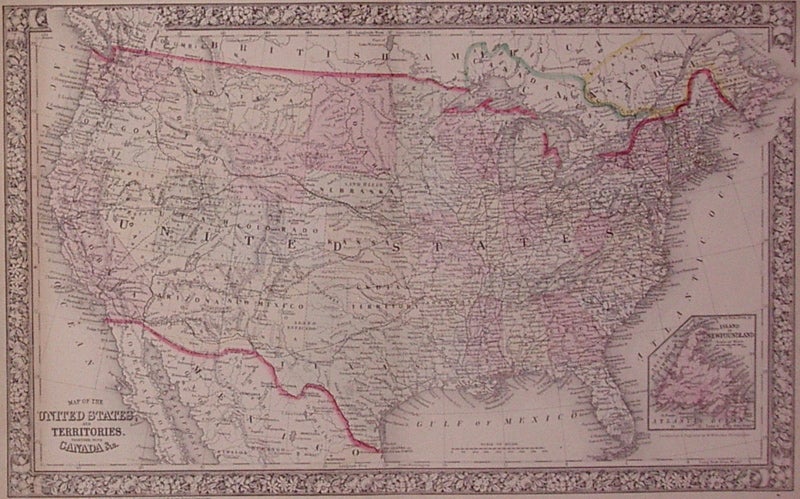
Map of the United States, and Territories. Together with Canada &c.
Philadelphia: Mitchell, Samuel Augustus Jr., 1860.
Map. Engraving with original hand coloring. Image measures 13.25" x 21".
Map of United States including an inset of Newfoundland.
Binding: Unbound
Condition: Very Good
Language: English
Price: $225.00
Item #202751
See all items by Wellington WILLIAMS