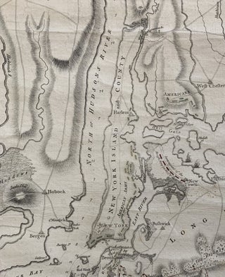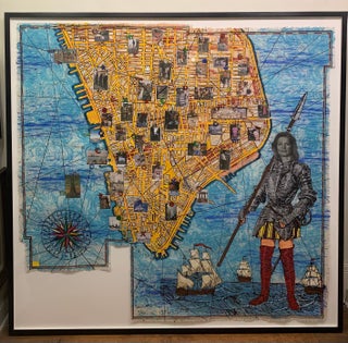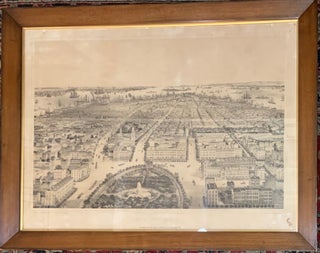
New York
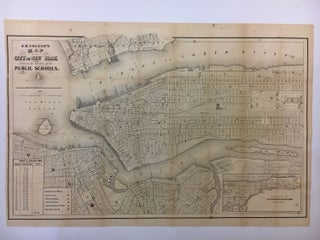
New York: Williams & Stevens, 1852. Lithograph, in antique frame, 26 3/4 x 34 3/4 inches. This dream like bird's eye view depicts New York City and Brooklyn in the mid 19th century. The perspective of Union Square, looking south from Union Square Park is unusual. Ships dot the rivers and the docks burst with activity. Bachmann has prominently featured the oval-shaped Union Square Park in the foreground, which had opened in 1839. Fashionable dwellings eventually circled the perimeter of..... More
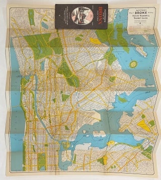
![Item #311502 Plate 139, Part of Section 7 [Harlem]. George W. BROMLEY, Walter S. BROMLEY](https://argosybooks.cdn.bibliopolis.com/pictures/311502.jpg?width=320&height=427&fit=bounds&auto=webp&v=1671041745)
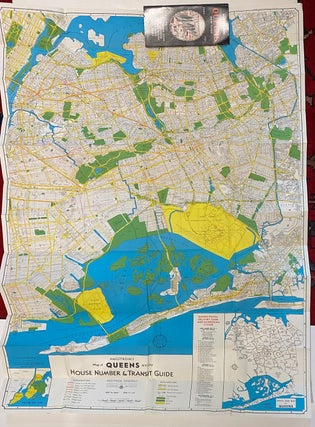
![Item #301369 Plate 163, Part of Section 8 [Washington Heights]. George W. BROMLEY, Walter S. BROMLEY](https://argosybooks.cdn.bibliopolis.com/pictures/301369.jpg?width=320&height=427&fit=bounds&auto=webp&v=1626466418)