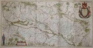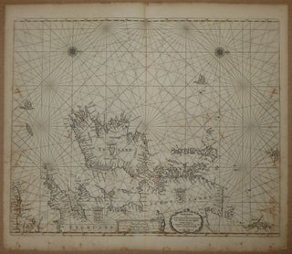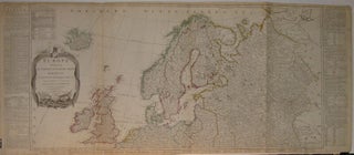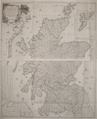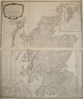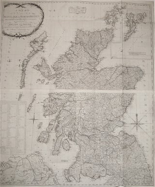
A New Map of Scotland or North Britain, Wherein all the Post and other Public Roads are correctly Delineated; with the adjacent parts of England and Ireland
London: Sayer and Bennett, 1782. Map, in two sheets. Copper plate engraving with original outline hand color. Each image measures 24.5" x 41.75". This two-part, large-scale wall map of Scotland depicts the country in intricate detail, with a particular focus on roads. has a particular focus on travel and post roads. Hand-colored lines divide and subdivide shires, mountains are depicted pictorially, and bodies of water such as lochs are all labeled. At the upper right is a large inset of..... More