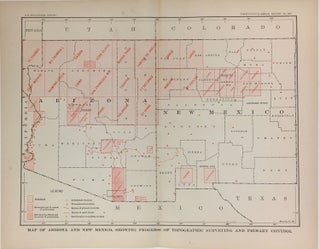
Map of Arizona and New Mexico, Showing Progress of Topographic Surveying and Primary Control
Washington: Government Printing Office, 1904. Map. 10" x 12 1/2". This detailed map of Arizona and New Mexico was included in the Twenty-Fifth Annual Report of the Director of the United States Geological Survey from 1903-4. More