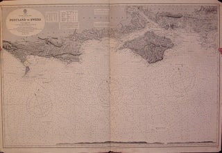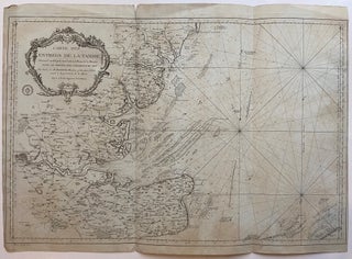
Carte des Entrees de la Tamise Dressee au Depost des Cartes et Plans de la Marine pour le Service des Vaisseaux du Roy
Paris: Jacques Nicolas Bellin, 1769. Sea Chart. Copper plate engraving with original hand coloring. Image measures 22.5" x 34". Includes depth measurements and rhumb lines as well as inland cities and geographical features. Some chipping and minor tears along bottom edge. Right margin missing. Jacques Nicolas Bellin (1703-1772), was the official hydrographer to the French king and the first person to hold the title of "Ingénieur de la Marine of the Depot des cartes et plans de la Marine" (chief..... More