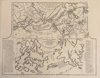
Carte Reduite Des Decouvertes Des Russes Entre l'Asia et L'Amerique
Paris: 1764. Map. Original engraving with hand colored outline. Published in Paris, 1764. Image measures 9 1/4" x 19 3/4" Beautifully engraved map of showing the discoveries of the Russian explorers between Asia and the Americas. Centered on present-day Alaska, this map shows the Bering Straits, with parts of northeastern Russia and northwestern North America. Mountains are depicted pictorially. Many Lakes and rivers are shown in North America. The map was published in Bellin's "Petit Atlas Maritime" which covered the..... More