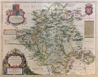
Palatinatus Posnaniensis in Maiori Polonia Primarii Nova Delineato Per G. F. M.
Amsterdam: Johannes Blaeu, 1662. Map. Hand colored engraving. 20 1/2" x 24". Classic Blaeu latin edition of the greater Polish area, centering on Posnan. Beautiful cartouches featuring cherubs, Polish heraldry, and the crown. The map is dedicated to Doctor Georg Freudenhammer. One of the most prolific Dutch mapmakers of his time, Willem Blaeu (1571-1638) started one of the most famous map publishing firms of the 17th century. It was at this time that the Dutch controlled the map trade, and..... More