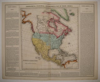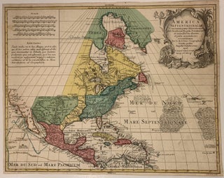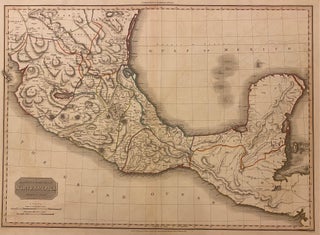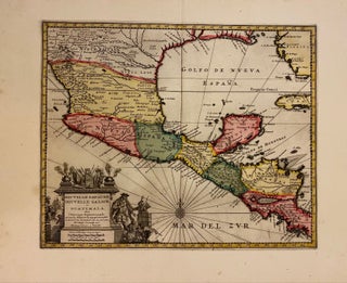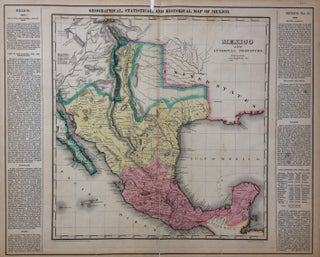
Geographical, Statistical, and Historical Map of Mexico.
Philadelphia: Carey & Lea, 1822. Map. Engraving with original hand coloring. Image measures 15"x 14.5", image plus text measures 16.5" x 20.5". This map of Mexico combines a detailed topographical and political rendering with information pertaining to history, climate and culture. It was published in 1822, shortly before Austin's arrival in Texas and immediately prior to Mexico's independence from Spain. The index of the map includes cities, rivers, military posts, and mines, and information about exploration and Indian population is..... More