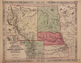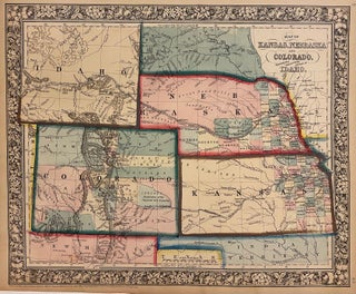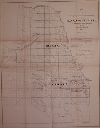
Map Showing the progress of the Public Surveys in Kansas and Nebraska, to accompany Annual Report of the Surveyor General
Leavenworth, Kansas: Surveyor General's Office, 1862. Map. Uncolored lithograph. Image measures 23" x 18.5". Early map illustrating the progress of public surveys in Kansas and Nebraska. Shows townships, towns, waterways, Indian reservations and trust lands. A fascinating look at the changing American west in the 1860s. Minor toning along original folds. The General Land Office was an independent agency in the United States that was in charge of mapping public domain lands. More