
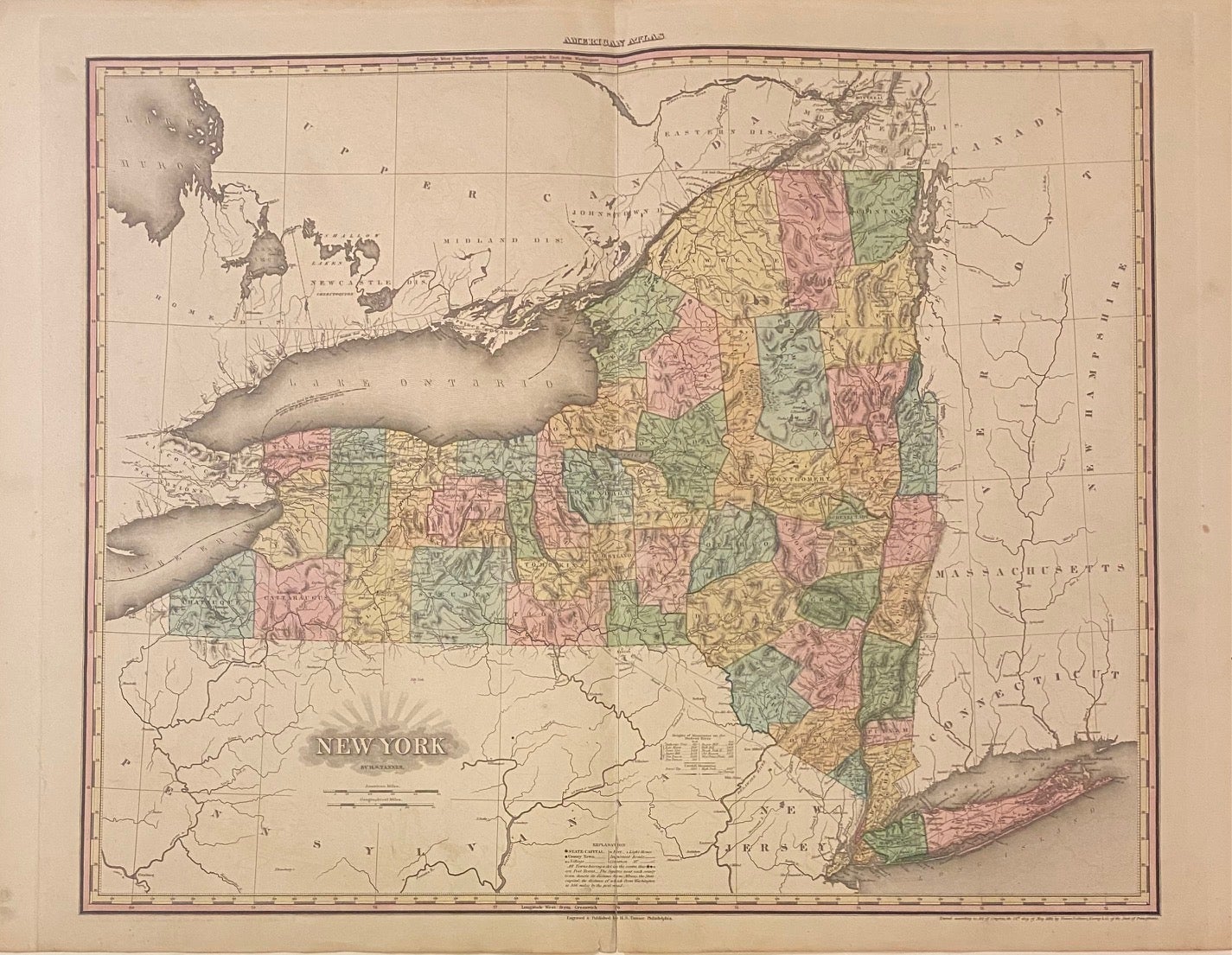
New York
Philadelphia: Tanner, H.S., 1825.
Map. Engraving with hand coloring. Image measures 22" x 26".
Beautiful large map of New York state divided into counties. Denotes towns, major routes, waterways and topographical features, all in beautiful detail, with elevation rendered by hachure. Dated and copyrighted to 1819. Map is in good condition with verso repair along centerfold. Some staining over New Jersey and offsetting throughout. Chipped lower margin repaired. Henry Schenck Tanner (1786-1858) was an American cartographer and statistical geographer. Born in New York, he moved to Philadelphia where he established his well-known publishing company with his brother. Tanner was the first American to publish a map of Texas, which subsequently went through eight editions. However, he is best known and most renowned for his New American Atlas. This fine map of New York is a wonderful example of his work.
Binding: Unbound
Language: English
Price: $1,200.00
Item #263222