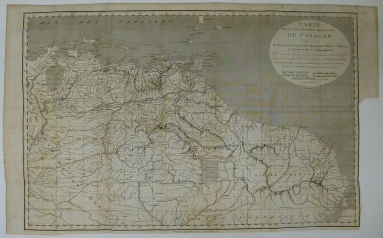
Carte De La Capitainerie Generale De Caracas Comprenant les Provinces de Venezuela, Maracaibo, Varinas, Cumuna, La Guiane et ifle de la Marguerite
1805.
Map. Uncolored engraving. Image measures 16" x 25". Page measures 17.25'' x 28''.
This is a rare 18th century map of Caracas and surrounding territories, including French Guyana. Include names of regions, rivers, mountains and islands. Published circa 1805. Trimmed to neat line as issued. There is some foxing and folds from wear but the map as a whole is in good condition. It is originally part of the 'Travels in Parts of South America, during the Years 1801, 1802, 1803, and 1804' by Francois Raymond Joseph de Pons. The book depicts De Pons travel through the Spanish New World before independence.
Jean-Baptiste Poirson was a French cartographer and geographer who lived from 1760 to 1831. He was a collaborator of the famous geographer Edme Mentelle (1730-1815).
Binding: Unbound
Condition: Very Good(-)
Language: French
Price: $695.00
Item #253045