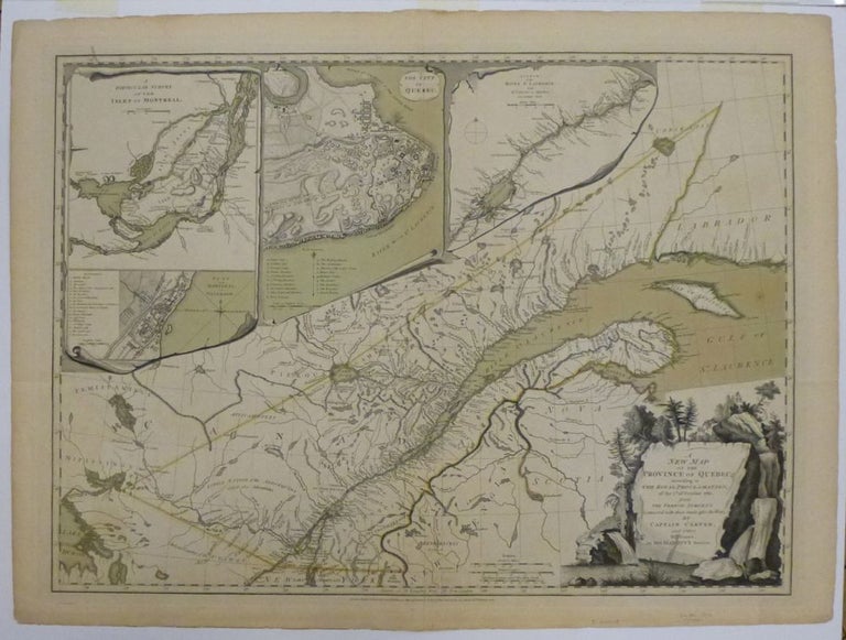
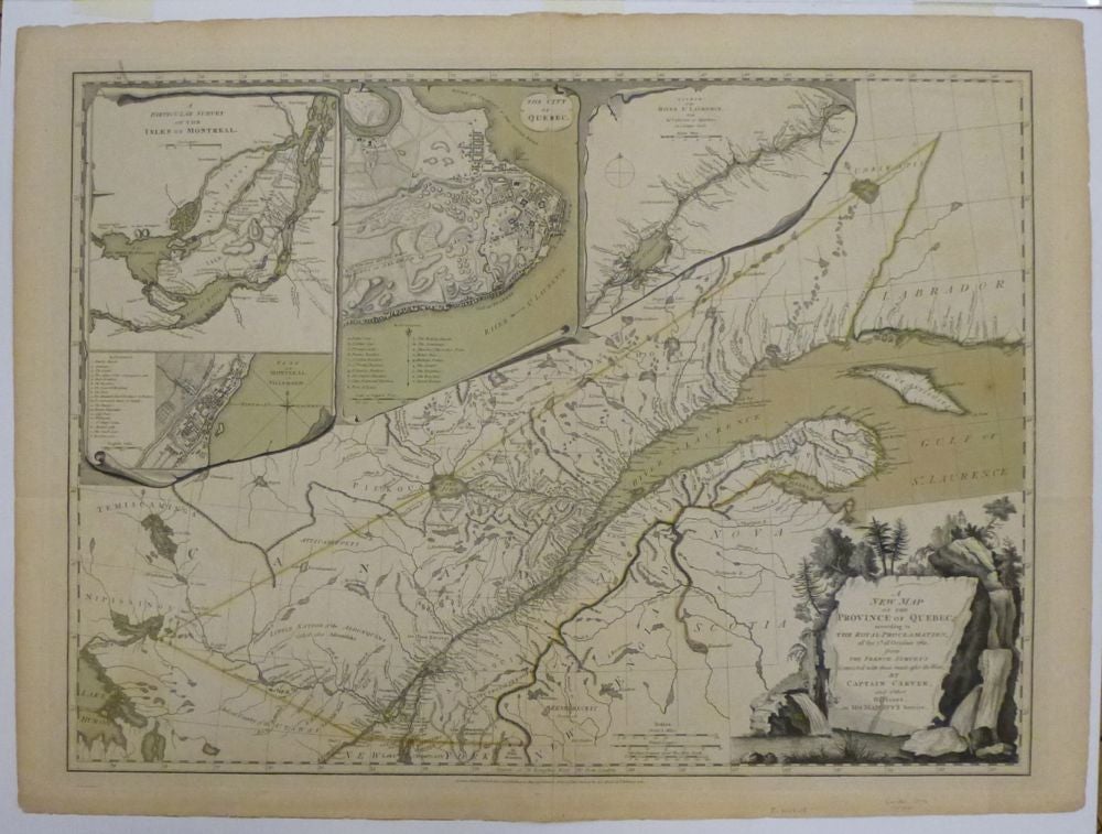
A New Map of the Province Of Quebec, according According to the Royal Proclamation, of the 7th of October, 1763, from the French Surveys Connected with those Made after the War by Captain Carver, and others in His Majesty's Service.
London: Robert Sayer & John Bennett, 1776.
Map. Engraving with original color wash. Page measures
This map shows the Province of Quebec as a newly acquired English territory according to the Treaty of Paris at the end of the French Indian War. Includes four lovely trompe l'oiel insets of the Isles of Montreal, Plan of Montreal, The City of Quebec, and the Course of the St. Lawrence. This British map extends the boundaries of Quebec into New England at a key point in the beginning of the Revolution. Captain Jonathan Carver (1732-1780) was a traveler, surveyor and cartographer who made this map based on his travels for Thomas Jeffery's American Atlas. Robert Sayer (1725-1794) was an important English publisher of maps, portraits, and nautical engravings. Partnering with John Bennett around the 1760s, the two published the works of well-known cartographers such as Kitchen, Jefferys, Belling, d'Anville and others. This is the first state of this scarce map.
Binding: Unbound
Language: English
Price: $1,950.00
Item #250419