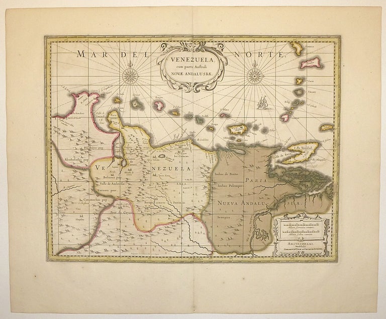
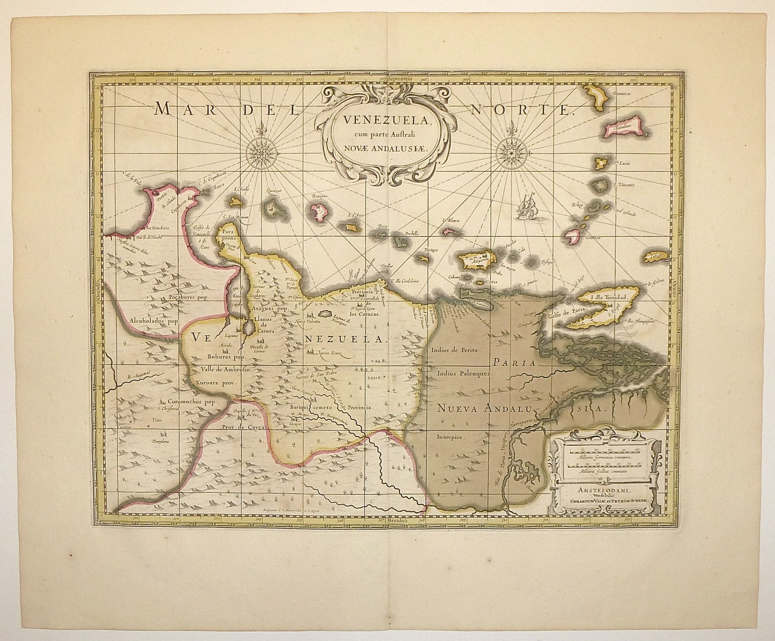
Venezuela Cum Parte Australi Novae Andalusiae
Amsterdam.
Map. Copperplate engraving with original hand coloring. Image measures 14.25 x 18.75". Sheet measures 19.75 x 24".
This fine map focuses on the Spanish colonial provinces of Venezuela and New Andalusia, corresponding roughly to the present-day Venezuelian states of Sucre, Venezuela, Anzoátegui and Monagas. Published circa 1700, the map shows the northern coastline labeled with important cities and ports. Above the coast, a string of offshore islands creates a pleasant visual rhythm set off by a decorative cartouche and two ornamental compass roses. This string contains portions of the Lesser Antilles, the Leeward Antilles, and the Windward Islands, including among others Aruba, Bonaire, Curacao, St. Lucia, Dominica, and Trinidad and Tobago. The lower half of the map is sparsely detailed, as little of the area had been explored beyond the coast by this time. However, pictorial mountains, trees and rivers animate the space with the topographic mystery of the unknown. The map is in excellent condition with deluxe margins.. Slight ghosting from original color. Petrus Schenk (c.1660--1711) was a German engraver and cartographer. He began his training in Amsterdam in the art of mezzotint and soon began working closely with Gerard Valck. The two took advantage of the bustling cartographic trade in the city and quickly expanded their business from portraits and prints into maps and globes. In 1700, Schenk grew the business further by moving to Leipzig, Germany and opening a shop. As his sons and grandson returned to the Netherlands to become active engravers as well, the Schenk firm developed into one of the best-known publishing houses in 18th-century Amsterdam. This map attests to Valck and Schenk's prolific production and skill in both cartographic artistry and business.
Language: Latin
Price: $800.00
Item #247131