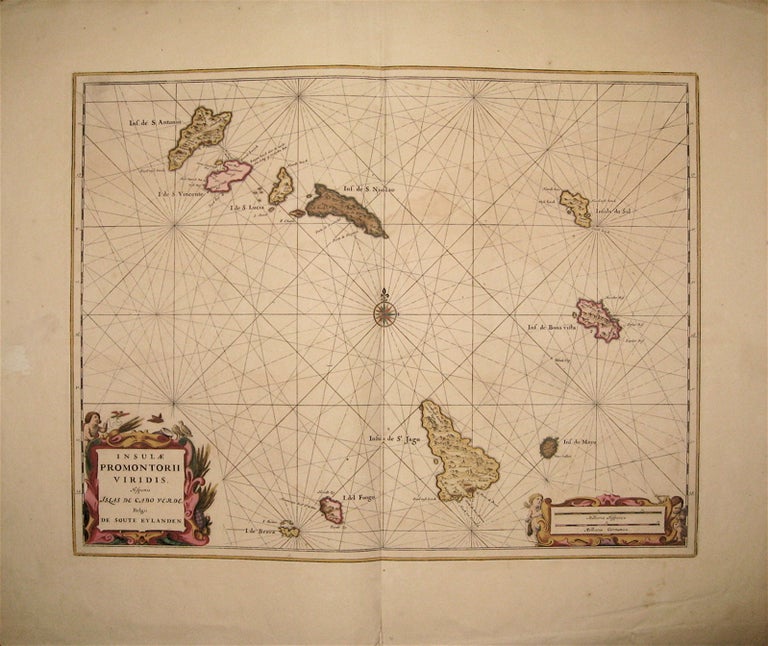
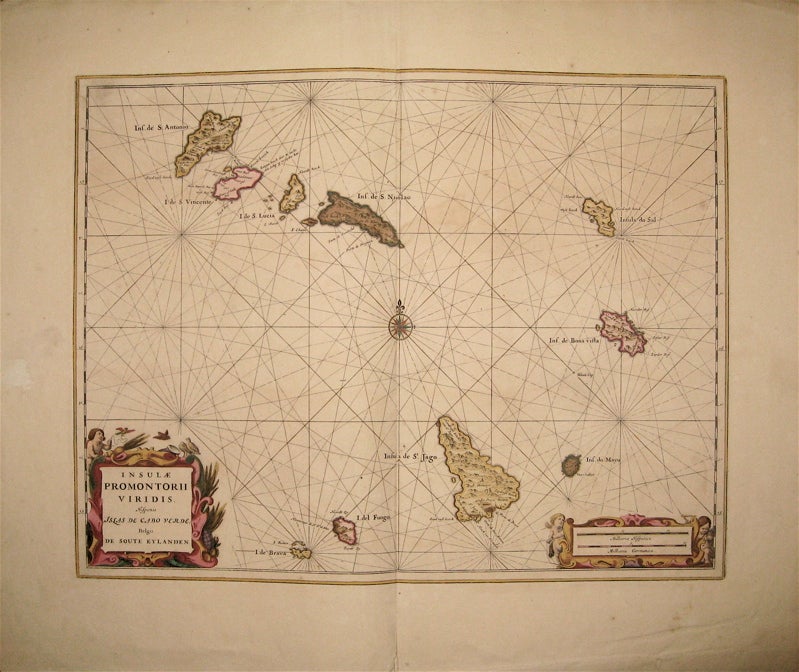
Insulae Promontorii Viridis, Hispania Islas De Cabo Verde
Amsterdam: Johannes Blaeu.
Map. Copper plate engraving with original hand coloring with highlights in gold. Image measures 15" x 19.5". Sheet measures 20.25 x 24".
This sea chart shows the Cape Verde Islands, an archipelago off the coast of Western Africa. The islands became particularly strategic starting in the 15th Century, when the Portuguese colonized them and utilized them as a stop in the Atlantic Slave Trade. The map is beautifully drawn with rhumb lines criss-crossing around a central compass rose. A decorative title cartouche and scale feature ornate frames adorned with cherubs and bucolic native wildlife. Small gold embellishment on the scale. One of the most famous mapmakers of his time, Willem Blaeu (1571-1638) and his family worked out of Amsterdam. This series was published by his son Johannes (c. 1599-1673), who took over the business upon his father's death.It is in very good condition with wide margins as issued. Few chips or tears, only slight damage to the bottom center seam, not affecting the image.
Binding: Unbound
Language: English
Price: $650.00
Item #239603