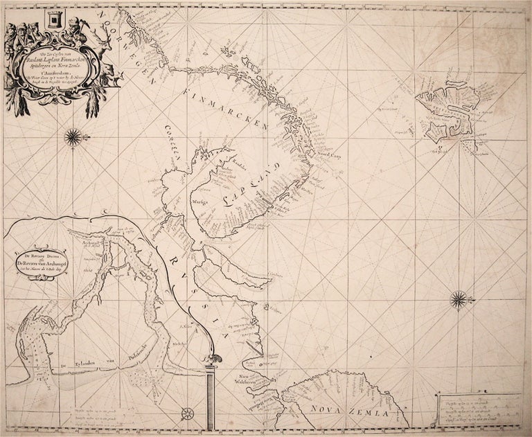
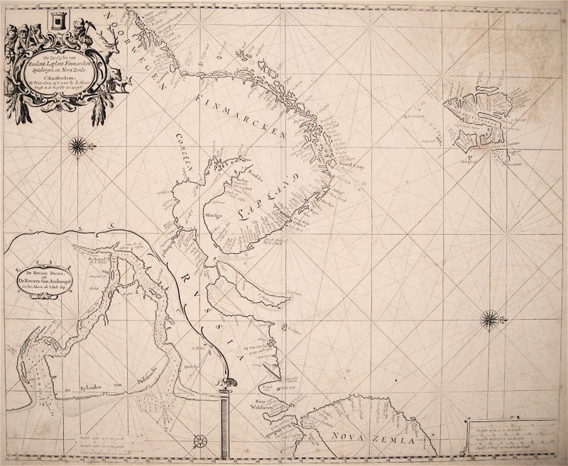
De Zee Custen van Ruslant, Laplant, Finmarcken, Spitsbergen en Nova Zemla
Amsterdam: 1669.
Sea chart. Uncolored copperplate engraving. Image measures 17.5" x 21.5".
This rare sea chart by Pieter Goos shows the coasts of Russia and Finland with north oriented to the right. The islands of Spitsbergen and the tip of Novaya Zemlya are also visible. An inset map, oriented with north to the lower right, shows the River Dvina as it flows through the city of Arkhangelsk (Archangel), the chief seaport of Russia at the time. In addition to ports, the map includes topographical features, soundings, sand bars, fishing banks and navigational hazards. Around Spitsbergen particularly are detailed demarcations of safe anchorage points and whaling stations from when the islands were used as a whaling base. The map also features rhumb lines, scales, and embellished compass roses. A figured title cartouche adorned with scrollwork and feathers shows inhabitants and wildlife of the region. This map was published in Goos' "De Zee-Atlas, Ofte Water-Weereld" and remains in its original uncolored state, which allows Goos' intricate line work to shine. It is in good condition with slight foxing, soiling, and off-setting, particularly of the cartouche. Very few chips and tears. Pieter Goos (1616-75) was a Dutch cartographer, engraver, publisher, printer, and print-seller based in Amsterdam. He belonged to a noted family of cartographers, headed by his father Abraham, who prepared plates for many maps published in the important atlases of the time. His pilot guide, the "Zee-Spiegel," provided some of the first charts of newly-explored regions in the West Indies and Western Africa. His "Zee-Atlas" is considered one of the best sea atlases of its time. This map is a fine example of Goos' high-quality, visually appealing sea charts.
Binding: Unbound
Language: English
Price: $1,150.00
Item #235597