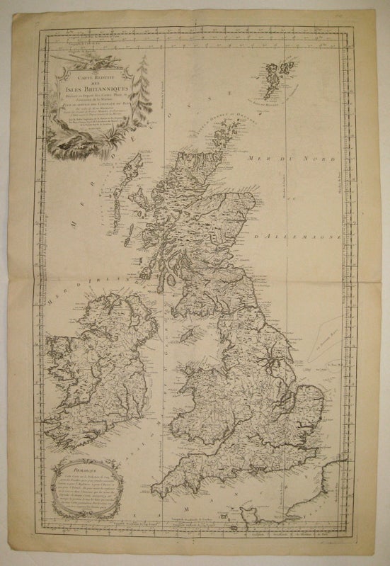
Carte reduite des isles Britanniques
1757.
Map. Copper engraving. Image measures 34.5 x 21.5".
Bellin designed this rare, large map of the British Isles for use by vessels of the King. As described in a "Remarque" set off in a decorative border in the lower left corner, the map is a reduced version of Bellin's earlier 5-part map of the region. This deluxe edition of the map is beautifully rendered and labeled, with names of cities, ports, counties, and rivers arranged to complement the country's geography and topography. An unusual feature is the labeling of sand banks and anchorages. In the top right, a decorative cartouche with a scenic landscape displays the title. The map is in very good condition, with light offsetting and a horizontal fold throughout. Full margins with very few chips and tears. Jacques Nicolas Bellin (1703-1772) was the official hydrographer to the French king and the first person to hold the title of "Ingénieur de la Marine of the Depot des cartes et plans de la Marine" (chief engineer of the French Hydrographical Office). He was particularly well-known for his maps of the French Empire, especially the territories in North America. This map is a fine example of his detailed work.
Language: English
Price: $675.00
Item #234323