
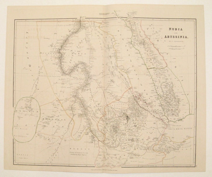
Nubia and Abyssinia
London: J. Arrowsmith, 1842.
Map. Engraving with original hand-coloring. Image measures 20.5 x 23.25".
This lovely map of Nubia and Abyssinia shows the upper Nile, Ethiopia, Sudan and the Yemen. Cities and towns are labeled, particularly as they occur along the region's rivers. Exploration and caravan routes are also included, attesting to the area's importance to trade in the mid-19th century. Annotations are scattered throughout the map and provide insight into contemporary knowledge of the terrain and its inhabitants, such as the description of Bertat as "Country mountainous & woody, inhabited by Pagan Negroes." Some information extends slightly outside the top border into the margin. The map is from Arrowsmith's "London Atlas of Universal Geography." It is in very good condition with no chips or tears. Paper is a bright white with some light off-setting. John Arrowsmith (1790-1873) was from a family of London based cartographers and publishers, and was a founding member of the Royal Geographical Society. His "London Atlas," known for its understated elegance, is considered one of the first truly "modern" atlases of the nineteenth century. This map is a fine example of Arrowsmith's work.
Language: English
Price: $350.00
Item #234304