![Item #234105 Pascaarte van Engelant Van 't Voorlant tot aen Blakeney waer in te sien is de mont vende Teemse [with] River van Londen. Pieter GOOS.](https://argosybooks.cdn.bibliopolis.com/pictures/234105.jpg?width=768&height=1000&fit=bounds&auto=webp&v=1337092387)
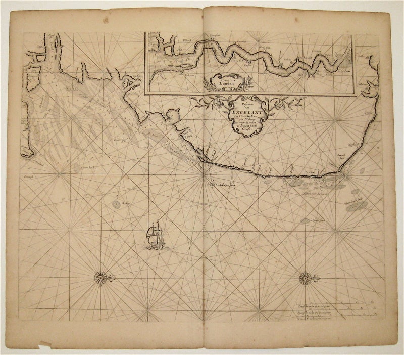
Pascaarte van Engelant Van 't Voorlant tot aen Blakeney waer in te sien is de mont vende Teemse [with] River van Londen
Amsterdam: 1665-66.
Map. Uncolored copperplate engraving. Image measures 17.5 x 21.5".
This sea chart depicts the British Isles with North oriented to the right. The map extends to include the English Chanel and coastline of Normandy. In addition to ports, the index also includes soundings, sand bars, fishing banks and navigational hazards. Each region is adorned with a decorative coat of arms, and embellished compass roses appear at the top and bottom of the map. This map was published in Goos' "De Zee-Atlas Ofte Water-Weereld" and remains in its original uncolored state, which allows Goos' intricate line work to shine. It is in good condition with slight foxing, soiling, and off-setting. Pieter Goos (1616-1675) was a Dutch cartographer, engraver, publisher, printer, and print-seller based in Amsterdam. He belonged to a noted family of cartographers, headed by his father Abraham, who prepared plates for many maps published in the important atlases of the time. His pilot guide, the "Zee-Spiegel," provided some of the first charts of newly explored regions in the West Indies and Western Africa, and his "Zee-Atlas" is considered one of the best sea atlases of its time. This map is a fine example of Goos' high quality, visually appealing sea charts.
Binding: Unbound
Language: English
Price: $1,000.00
Item #234105