
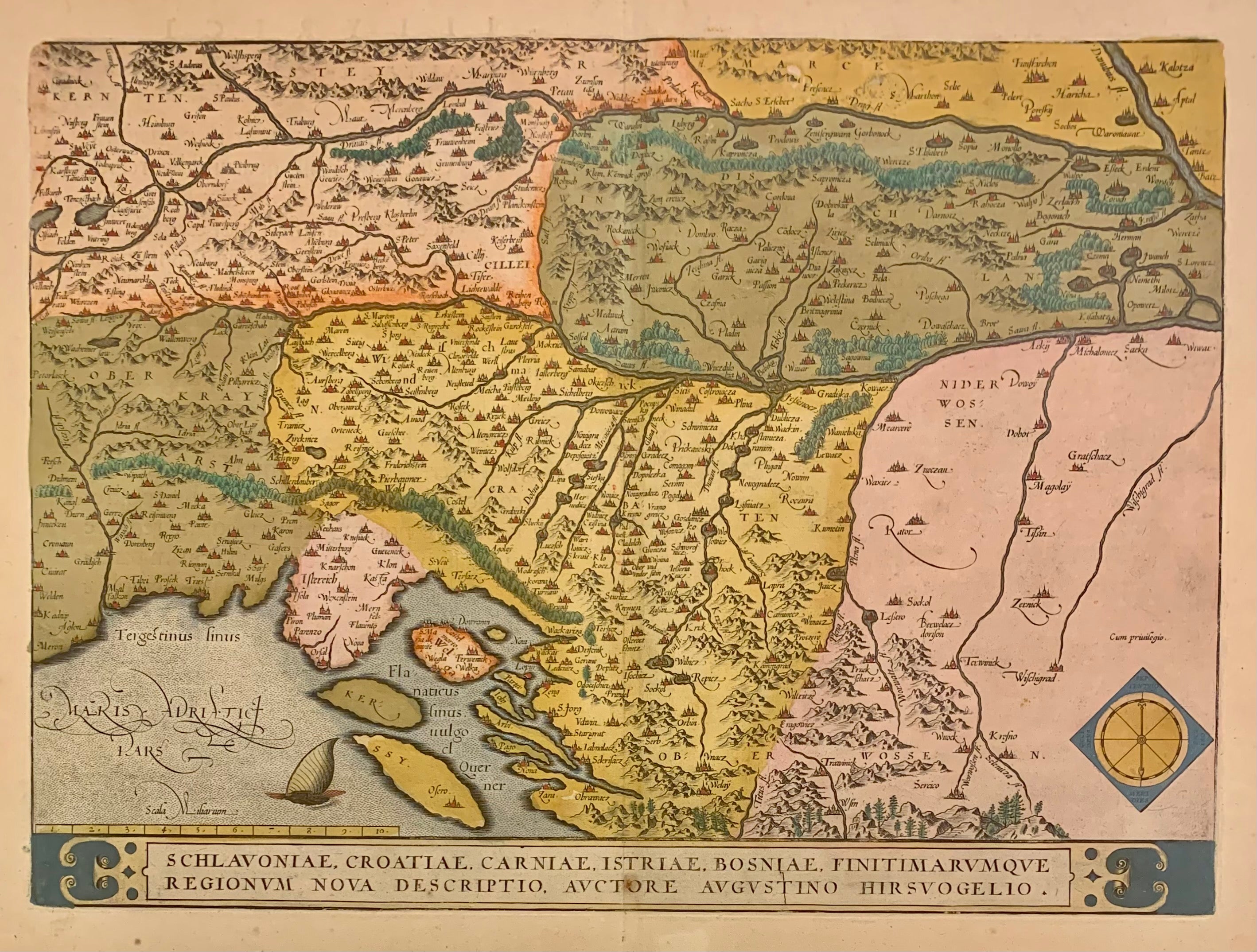
Schlavoniae, Croatiae, Carniae, Istriae, Bosniae, Finitimarumque Regionum Nova Descriptio...
Antwerp: Abraham Ortelius, 1603.
Map. Engraving with original hand coloring. Image measures 13.25" x 18.25".
Beautifully colored map of Croatia. Shows place names, topographical and geographical features, a compass rose and a ship in the Adriatic. Latin text on verso. From "Theatrum Orbis Terrarum". Light scattered stains to margins and cartouche. Minor abrasion to upper right. A few small chips and tears to edges. Abraham Ortelius (1527--1598), a Flemish cartographer and geographer, is widely regarded as one of the important and influential cartographers in history. He is known for his "Theatrum Orbis Terrarum," which was the first modern atlas. Van den Broecke 145
Binding: Unbound
Condition: Very Good(+)
Language: Latin
Price: $450.00
Item #228104