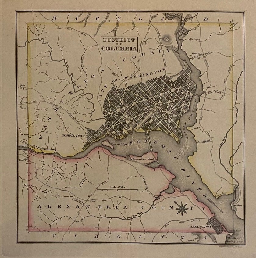
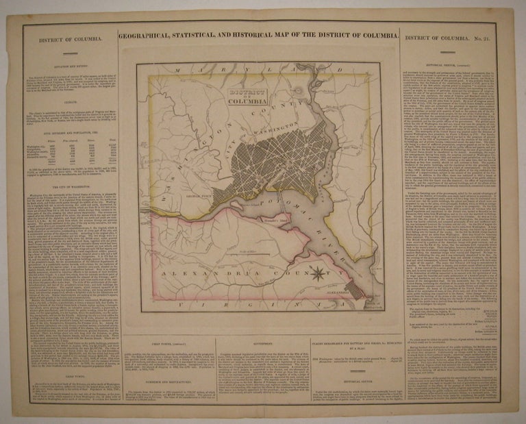
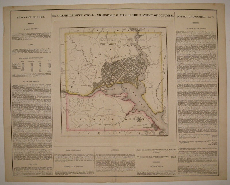
Geographical, Statistical, and Historical Map of the District of Columbia.
Philadelphia: Carey & Lea, 1822.
Map. Engraving with original hand coloring. Image measures 10.75" x 10.5", image plus text measures 16.5" x 20 5/8".
Beautiful double page map of Washington D.C. and its environs, including Alexandria. Shows street plan, major roads, waterways, marshlands and topography. Extensive information pertaining to history, climate and culture surrounds map. From "A Complete Historical, Chronological, and Geographical American Atlas...". Crease to upper right, light spots of foxing to top margin. Expert repair to centerfold.
Binding: Unbound
Condition: Very Good(+)
Language: English
Price: $650.00
Item #226827