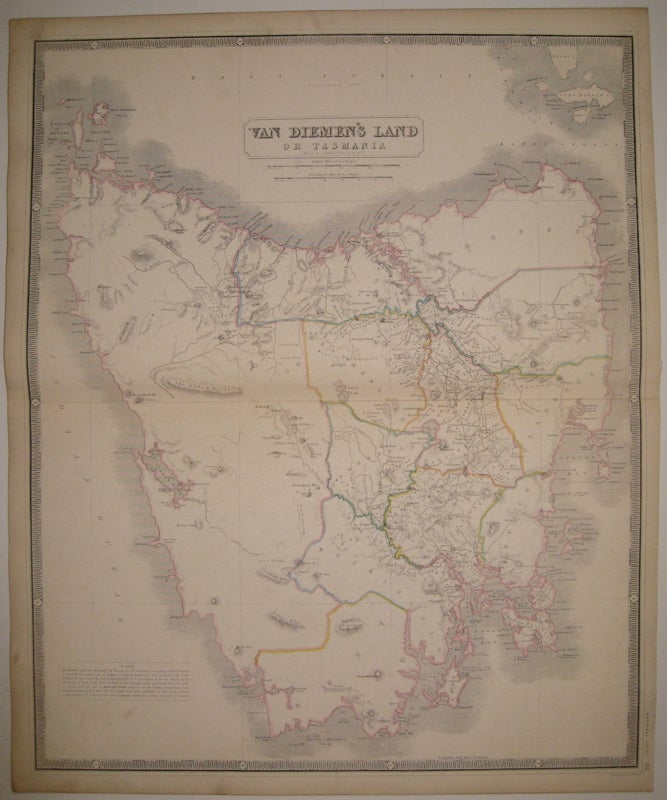
Van Diemen's Land or Tasmania
Edinburgh.
Map. Engraving with original hand outline color. Image measures 24" x 19.75".
Beautiful and clear double page map of Tasmania divided into counties, circa 1850. Features towns, major routes, waterways and topographical features in great detail. A note at lower left briefly explains the island's colonial history. A.K. Johnston (1804-1871) was a Scottish geographer and Fellow of the Royal Geographical Society. Partnered with his brother William, Johnston maintained a prolific map publishing firm throughout the 19th century. Their output ranged from globes, to atlas and wall maps. Minor scuffing.
Binding: Unbound
Condition: Very Good(+)
Language: English
Price: $300.00
Item #224927