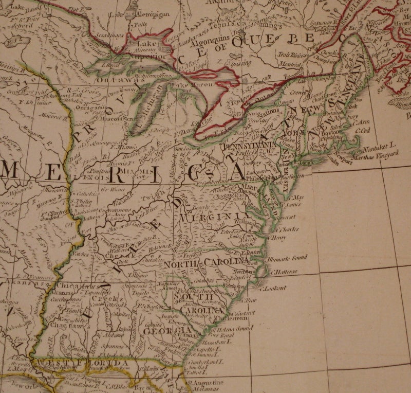


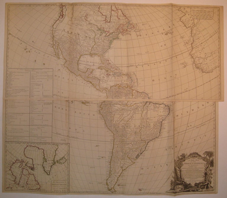
A New Map of the Whole Continent of America, Divided into North and South and West Indies, wherein are exactly the Described the United States of North America as well as the Several European Possessions according to the Preliminaries of Peace signed at Versailles Jan. 20, 1783...
London: Laurie & Whittle, 1794.
Map in four sheets joined into two panels (top and bottom). Engraving with original hand outline color. Each panel measures about 20.25" x 46 5/8".
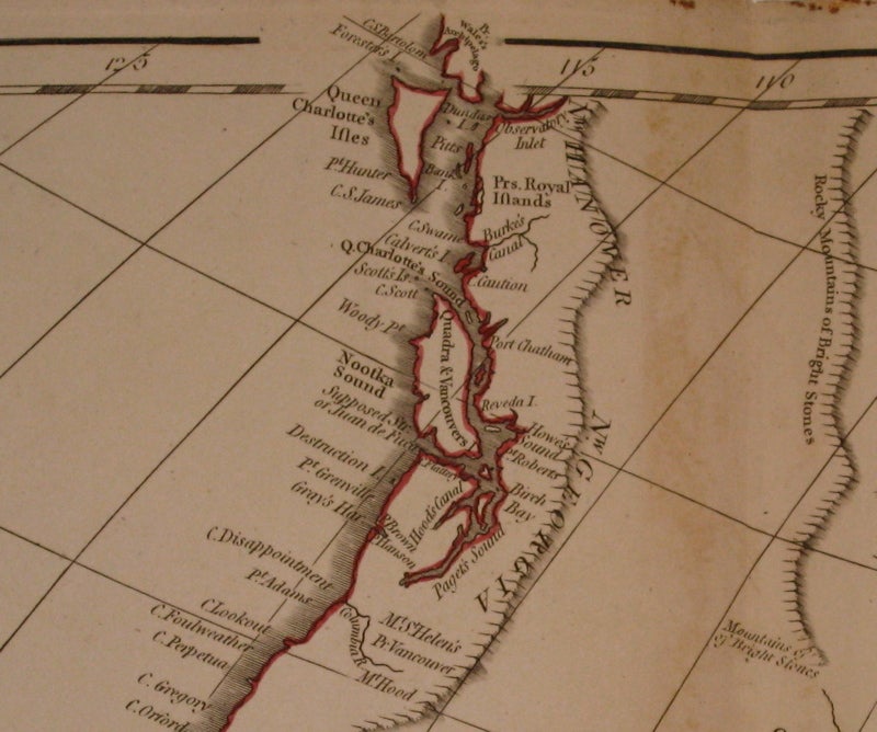
Outstanding wall map of the Americas and West Indies, reflecting the political boundaries decided upon in the Treaty of Versailles or Peace of Paris of 1783 which ended the American Revolutionary War. Fantastically detailed topographical and geographical elements, place names and Native American tribes. Includes elaborate title cartouche with an alligator, waterfall, palm trees and other flora. Includes an inset of northern Canada featuring Hudson and Baffin Bays, and an inset listing political land holdings, which are also represented through color outline: British holdings in red, American in green, Spanish in yellow and French in blue. Interestingly, the west coast of Newfoundland is blue, indicating French fishing rights. Originally published in 1763, this last edition has major updates to the Pacific Northwest based upon the explorations of Captain George Vancouver of 1791-95. Whereas previous editions note only the mythical Chinese colony of Fousang, this edition details Vancouver and Queen Charlotte Islands, Puget Sound, Mount St. Helens, Mount Hood and two mountain ranges. Light overall offsetting. Minor toning along join to both panels. Small tear to bottom edge of top panel. Creasing to bottom panel.
Binding: Unbound
Condition: Very Good(+)
Language: English
Price: $3,750.00
Item #224672