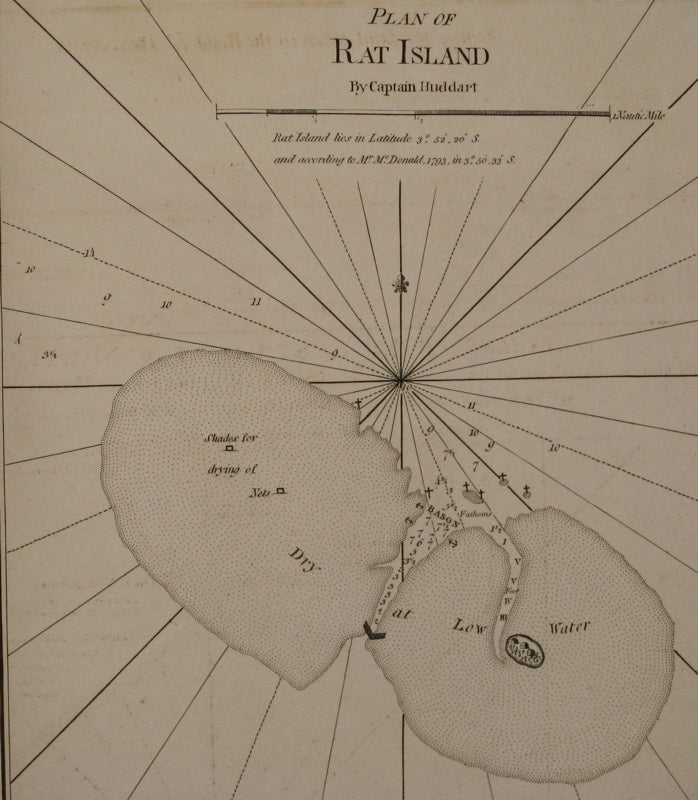


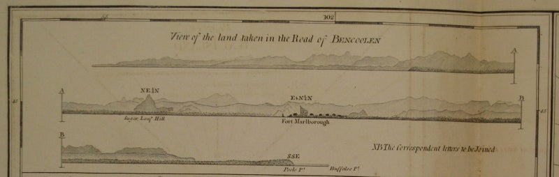
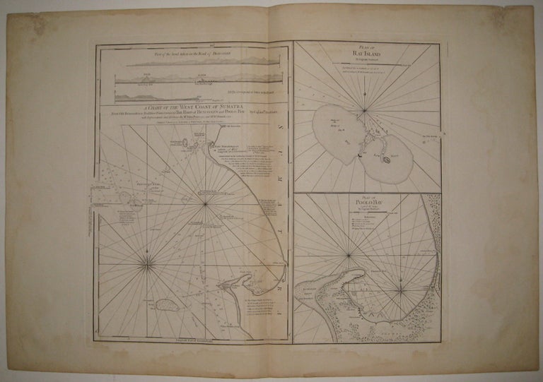
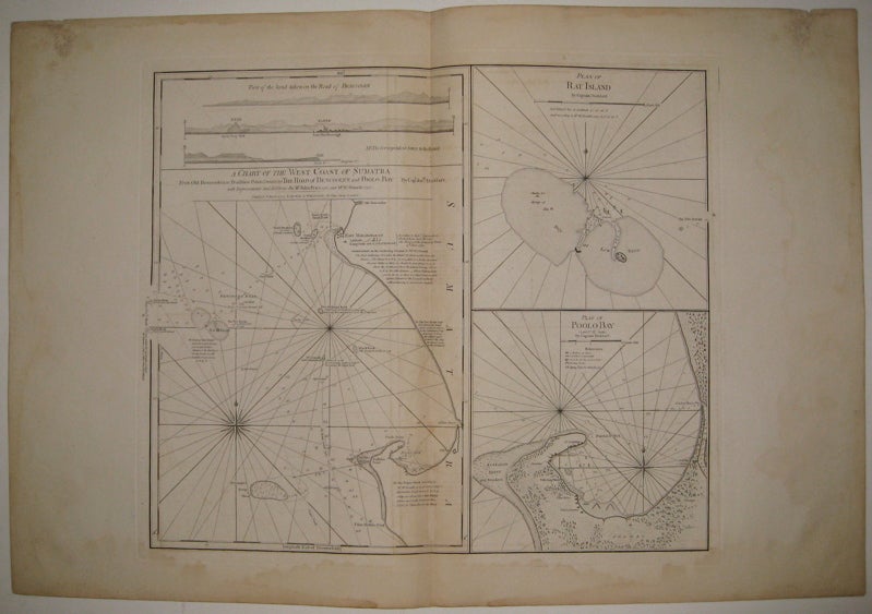
A Chart of the West Coast of Sumatra from Old Bencoolen to Buffaloe Point containing the Road of Bencoolen and Poolo Bay
London: Laurie & Whittle, 1799.
Sea chart. Uncolored copper plate engraving. Image measures 20.5" x 24.25".
Beautiful chart of the southwestern coast of Sumatra. Includes rhumb lines, depths, shoals and inland swamps, the paths of previous explorations, a compass rose and two inset maps: "Plan of Rat Island", "Plan of Poolo Bay". The coast lines are further illustrated with with several topographical cross sections and scattered sailing notes and observations. Also shown is Fort Marlborough in what is today Bengkulu, which guarded an important port for the British East India Company. Published in "The East-India Pilot, or Oriental Navigator, on One Hundred and Eighteen Plates: Containing a Complete Collection of Charts and Plans, &c..." (plate 93). Maps are based on the 1745 French "Neptune Oriental" by Jean Baptiste Nicolas Denis d'Apres de Mannevillette. The later English editions include additions by Captain Joseph Huddart, John Price and Mr. McDonald. Minor dampstaining and offsetting with some stains to upper corners. Full original margins.
Binding: Unbound
Condition: Very Good
Language: English
Price: $1,000.00
Item #220058