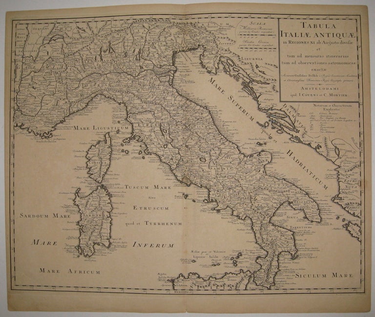
Tabula Italiae Antiquae in Regiones XI ab Augusto divisae et tum ad mensuras itinerarias tum ad observationes astronomicas exactae
Amsterdam: J. Covens et C. Mortier, 1739.
Map. Uncolored engraving. Page measures 19" x 24 3/8".
Richly printed classical map of Italy including Sardinia, Corsica and part of Sicily. Lowell City Library stamp (1844) in upper left corner. Minor overall aging. Guillaume Delisle (1675-1726) was a legendary French cartographer known for introducing a new standard of accuracy into 17th-century mapmaking. He was one of the cartographers who propelled the French school of map-making away from Dutch dominance. The French school emphasized science and accuracy over ornament. He used astronomical observations to determine locations and draw more precise coastlines and he continued to update his maps in order to dispel prevailing geographical inaccuracies throughout his life. His wife Marie Angelique Delisle and her family took over the business and kept publishing maps well into the late 18th century.
Binding: Unbound
Condition: Very Good
Language: Latin
Price: $750.00
Item #219709