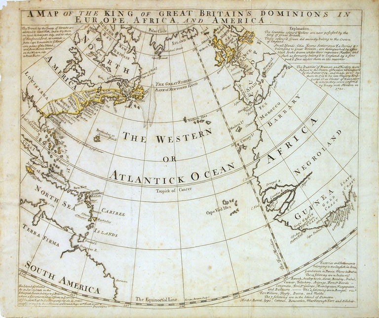
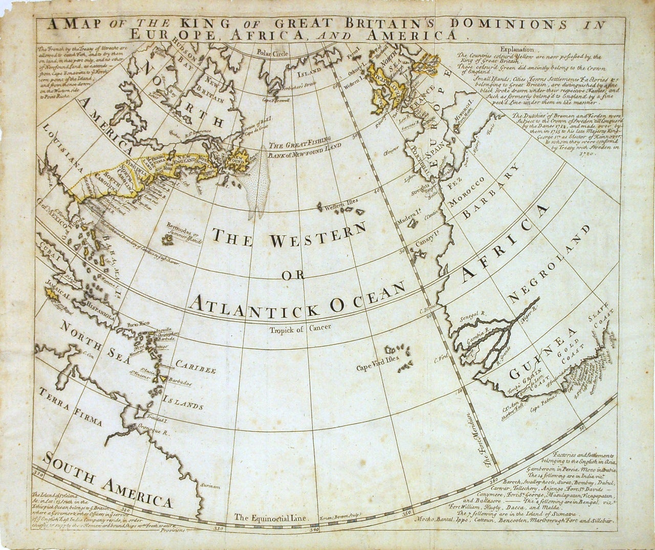
A Map of the King of Great Britain's Dominions in Europe, Africa, and America.
London: Bowen, Emanuel.
Map. Engraving with color outline. Image measures 14 9/16" x 17 5/16".
Scarce antique map of the Atlantic Ocean printed in 1740. It shows the English empirical reaches on a circular projection. Showing the eastern coasts of North and South America, the West Indies, Great Britain, Spain and Portugal and part of France, Morocco and the western coast of Africa. In North America the map names Nova Scotia, New England, New York, Pennsylvania, Maryland, New Jersey, Virginia, North Carolina, South Carolina and Georgia (first recognized as a colony in 1733). In Africa, referred to as "Negroland", the Grain Coast, Gold Coast and Slave Coast are all denoted. The surrounding text describes the the color coding of the map (current and former British possessions), the Treaty of Utrecht (which among other things, detailed the relationship between the French and the British in North America in 1713), a treaty with Sweden in 1720, a list of British settlements in Asia and a description of the Island of St. Helena. Overall foxing and toning, minor wear and chipping to edges. Emanuel Bowen (1714-1767) was an English map engraver who served as Royal Mapmaker to George II of England and Louis XV of France. He was well-regarded for his large, detailed, and accurate maps.
Binding: Unbound
Condition: Very Good
Language: English
Price: $1,500.00
Item #215118