
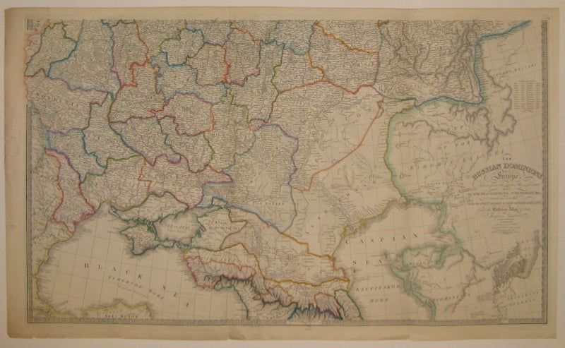
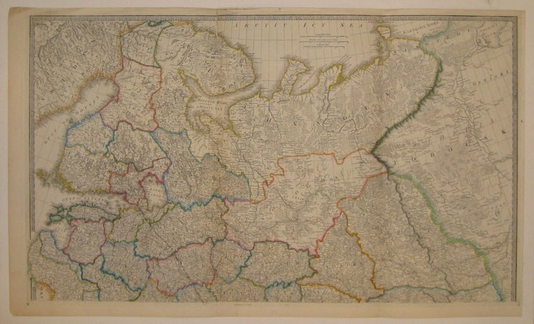
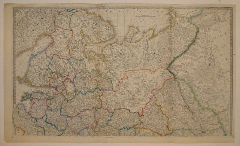
The Russian Dominions in Europe, drawn from the latest Maps, printed by the Academy of Sciences, St. Petersburg; revised and corrected, with the Post Roads & New Governments, from the Russian Atlas of 1806
London: James Wyld, 1845.
Map in two sheets. Engraving with original hand outline. Top sheet measures 23" x 38.25", bottom sheet measures 23.25" x 38.5". Each image measures 21.25" x 36.5".
Beautifully detailed map of the western portion of Russia. First edition published in 1808 by Wyld's master, William Faden. Minor wear to top sheet; tears to edges of bottom sheet.
Binding: Unbound
Condition: Very Good
Language: English
Price: $750.00
Item #209716
See all items by Jaspar NANTIAT