
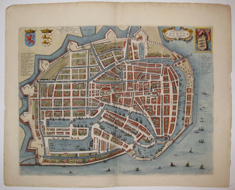
Topographia Enchusae
Amsterdam.
Map. Engraving with original hand coloring. Image measures 15.5" x 20".
Exquisite town plan of Enkhuizen, circa 1649, shown in an unusual panoramic birds-eye view. Beautifully detailed, with delicately rendered ships in the various waterways around the city. Includes two coats of arms. Dutch text on verso. Published around the time of the Spanish acknowledgment of the Dutch Republic in "Tooneel der Steden van der Vereenighde Nederlanden" ("Town books of the Netherlands"). Many of the town plans included in this publication emphasized their strategic importance in response to the Spanish occupation. One of the most famous mapmakers of his time, Willem Blaeu (1571-1638) and his family worked out of Amsterdam. This series was published by his son Johannes (c. 1599-1673), who took over the business upon his father's death. Minor chipping along edges, tear to left edge. Crease to upper left corner.
Binding: Unbound
Condition: Very Good
Language: Latin
Price: $850.00
Item #208481