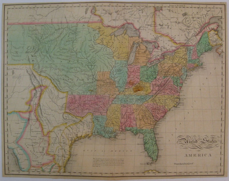
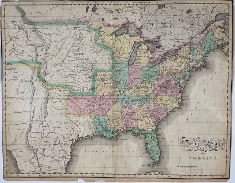
United States of America
Philadelphia: Carey & Lea, 1827.
Map. Engraving with original hand coloring. Image measures 16.75" x 21.5".
Beautiful double-page map of the United States from East Coast to Midwest, printed in 1827, made after John Melish's seminal map of the United States. Hand colored to show states and territories, the map shows the states of Maine, New Hampshire, Vermont, Massachusetts, Rhode Island, Connecticut, New York, New Jersey, Pennsylvania, Maryland, Delaware, Virginia, North Carolina, South Carolina, Georgia, Florida, Alabama, Mississippi, Louisiana, Tennessee, Kentucky, Ohio, Indiana, Illinois, and Missouri, as well as Michigan Territory, North West Territory, and "Arkansa" Territory. The expansive northwest region, previously labeled as "Missouri Territory" in earlier editions of this map, has been updated to prominently feature the Black Hills. Significant changes were also made to the rivers, and additional regarding Native American settlements in the region. The coloring also differs from earlier editions, with the northwest region outlined in color liked Mexico and Canada, instead of filled like the states and territories; regional delineations in Mexico and Canada were also left uncolored in this edition. Information on the map to surveys made by Lewis & Clark, Pike, and later, Major Long. Topography is depicted pictorially. Cities, towns, rivers, and Native American nations are labeled throughout. In very good condition. Margins cropped, small chips to edges, two archival repairs to lower margin. Minor toning along lower centerfold.
The Philadelphia-based firm of Carey & Lea of Philadelphia was one of the most important publishers in the early 19th-century United States. Run by Henry Carey (1793-1879) and Isaac Lea (1792-1886), the company worked with both books and maps, specializing particularly in political commentary. Their "Complete Historical, Chronological, and Geographical American Atlas," first published in 1822, not only contained some of the earliest maps of western states being admitted to the Union, it also provided ample information on each states - providing an invaluable window into the nation's history.
Illustrator: Tanner, Benjamin
Binding: Unbound
Condition: Very Good(+)
Language: English
Price: $1,200.00
Item #207512