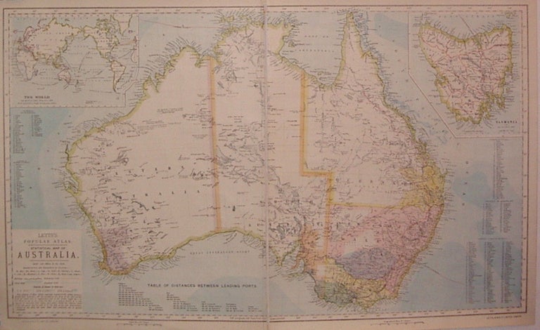
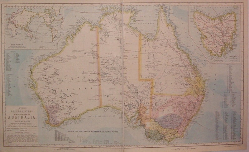
Statistical Map of Australia
London: Letts, Son & Co.
Map. Color lithograph, mounted on linen. Image measures 16" x 26.75".
Nicely detailed map of Australia, with paths of exploration, railroads and other landmarks. Includes insets of of Tasmania (known as Van Diemen Land until 1856), and the world with "distances from Australian ports". Lists of counties and distances between ports are scattered about page. From Letts's Popular Atlas, which was published 1881-1884. Only faint scattered foxing in margins. Thomas Letts (1803-1873) was an English stationer and printer who went into business with his son Charles in 1870. They published a wide range of materials in addition to atlases such as interest tables, specialist clerical and medical diaries, calendars, parliamentary registers, ledgers, and logbooks, and they were best known for popularizing the diary.
Binding: Unbound
Condition: Very Good
Language: English
Price: $150.00
Item #206523