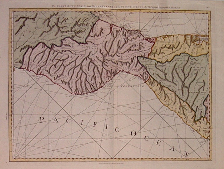
The Coast of New Spain from Nueva Vera Cruz to Triste Island
London: Laurie and Whittle, 1794.
Map. Engraving with hand coloring. Image measures 19" x 24.75".
Map of the south eastern portion of Mexico's coast, including the Isthmus of Tehuantepec. Beautiful topographic features, major roads and rhumb lines. From Jefferys' "West India Atlas", originally published by Sayer & Bennett in 1775. Full original margins, a few ink stains around plate line. Thomas Jefferys (1710-1771) was one of the most important and prolific mapmakers of his era with particular focus on North America.
Binding: Unbound
Condition: Very Good
Language: English
Price: $650.00
Item #206104
See all items by Thomas JEFFERYS