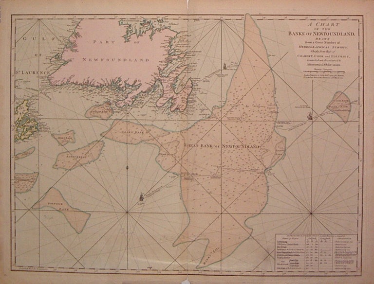
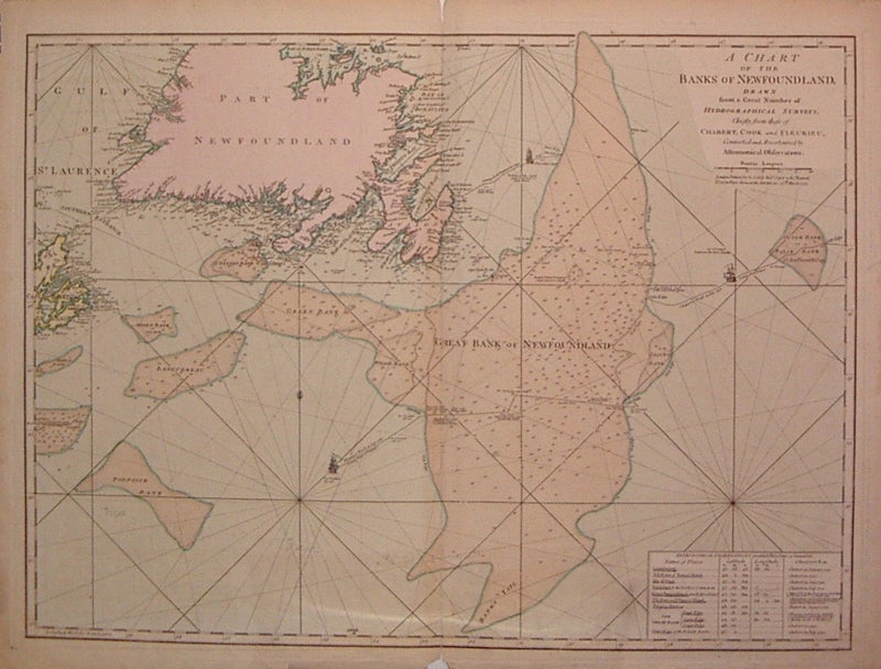
A Chart of the Banks of Newfoundland, drawn from a Great Number of Hydrographical Surveys, Chiefly from those of Chabert, Cook and Fleurieu, Connected and Ascertained by Astronimical Observations.
London: Robt. Sayer & Jn. Bennett, 1775.
Sea chart. Engraving with full original hand coloring. Image measures 19.5" x 26.25".
Map of the Grand Banks of Newfoundland, one of the most heavily fished areas of the world, with deluxe coloring. Includes three ship illustrations representing the voyages of Chabert, Cook and Fleurieu, inset of astronomical observations on which the chart is based, as well as depths and rhumb lines. This edition was published by Robert Sayer and John Bennett in 1775. Large repair to bottom center margin that does not effect image, some staining along edges otherwise in beautiful condition. Thomas Jefferys (1710-1771) was one of the most important and prolific mapmakers of his era with particular focus on North America.
Binding: Unbound
Condition: Very Good
Language: English
Price: $650.00
Item #204037