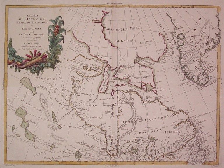
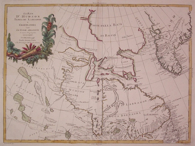
La Baja D'Hudson Terra di Labrador e Groenlandia con Le Isole Adiacenti di nuova Projezione
Venice: Antonio Zatta, 1778.
Map. Engraving with original hand coloring. Image measures 11.75" x 16".
Beautiful map of Canada centered on Hudson's Bay and Labrador. Indigenous names are noted and Greenland is shown. Some discoloration along edges and centerfold at margins.
Antonio Zatta (1775-1797) was the most prominent Italian map publisher of the late 18th century. His Venice-based publishing company produced maps that mark an important transition from 18th- to 19th-century cartographic styles. He updates and redefines the traditional title cartouche by replacing the mythic elements common in earlier maps with more representative images.
Binding: Unbound
Condition: Very Good
Language: Italian
Price: $450.00
Item #203871