
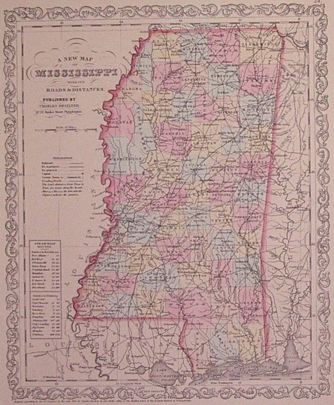
A New Map of Mississippi with its Roads & Distances.
Philadelphia: Thomas, Cowperthwait & Co., 1857.
Map. Engraving with original hand coloring. Image measures 14" x 11.5".
Nice clean map of Mississippi divided into counties. Shows major cities, major routes, waterways and railroads. Includes table of steam boat routes. From the "New Universal Atlas". In excellent condition. Plate was originally published by Samuel Augustus Mitchell, who sold the copyright to Thomas, Cowperthwait & Company in 1850, which was in turn bought by Charles Desilver in 1856.
Binding: Unbound
Condition: Very Good(+)
Language: English
Price: $125.00
Item #203191
See all items by Charles DESILVER