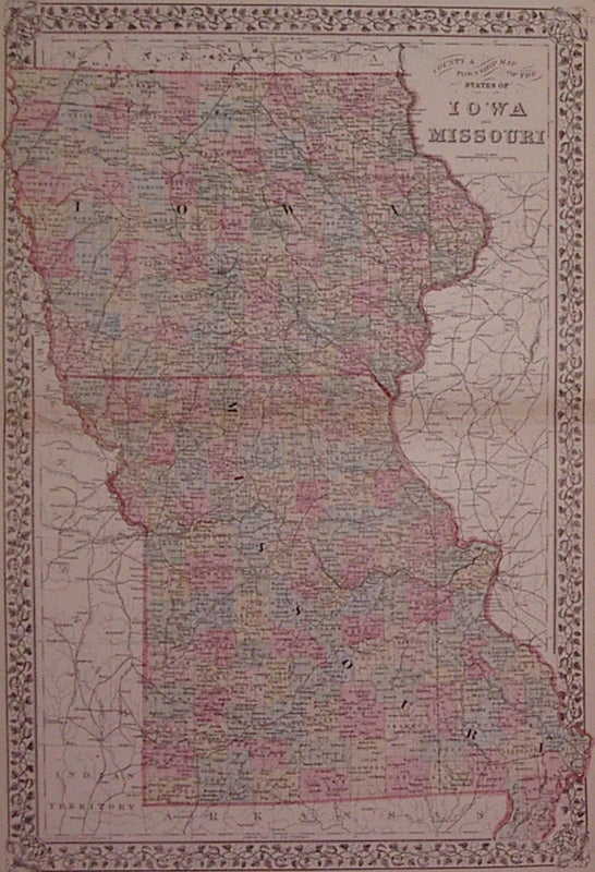
County & Township Map of the States of Iowa and Missouri
Philadelphia: Mitchell, Samuel Augustus Jr., 1882.
Map. Engraving with original hand coloring. Image measures 21.5" x 14.5".
Great double page map of Iowa and Missouri divided into counties. Showing townships, towns, major routes, waterways and railroads. Plan of St. Louis on verso. In excellent condition with only very slight crease along centerfold edges. S. Augustus Mitchell Jr. continued his father's successful mapmaking and publishing business, and was one of the most prolific and renowned 19th century American publishers.
Illustrator: Gamble, W.H.
Binding: Unbound
Condition: Very Good(+)
Language: English
Price: $65.00
Item #202998
See all items by Samuel Augustus Jr MITCHELL