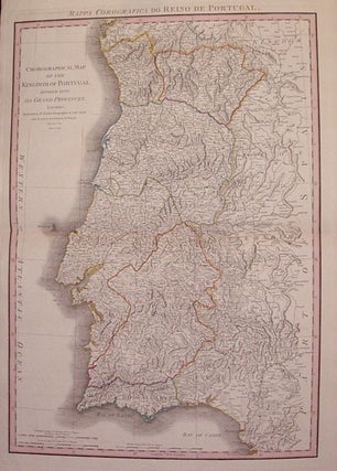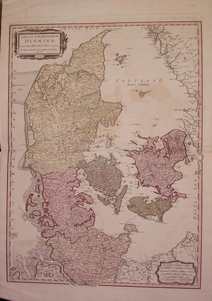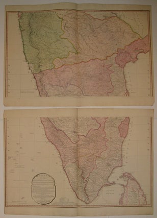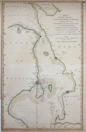
Chart of the Straits between Denmark and Sweden, Shewing the Passage from the Kattegat through the Sound, to Copenhagen Road, and thence through the Grounds to the Entrance of the Baltic
London: William Faden, 1801. Map. Engraving with hand coloring. Image measures 24"x15 1/4". This scarce sea chart of the strait between Denmark and Sweden covers the Öresund between the island of Zealand or Sealand and the southern tip of Sweden. The chart notes numerous depth soundings in fathoms as well as coastal features, anchorages, lighthouses, navigational hazards, towns, important roads and other information useful to a mariner. Important cities of Copenhagen, Malmo and Landscrona are identified with important buildings and..... More