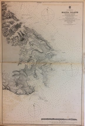
Malta Island South East Portion
London: Hydrographic office, 1896. Sea chart. Lithograph. 40" x 27". Shows some light damp-staining. Has some image loss along center fold line, otherwise in very good condition. A sea chart showing the south eastern coast of Malta in detail. Soundings are indicated in fathoms and lighthouses are denoted with yellow and red hand coloring. Based on surveys taken by Ship Stork in 1894. Admiral Sir William Wharton (1843-1905) was the Hydrographer of the Royal Navy from 1884 until his death..... More