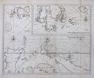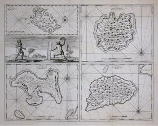
Caart van het Eyland Manipa / Caart van het Eyland Noessa-Laoet / Caart van het Eyland Honimoa / Caart van het Eyland Oma
Amsterdam: Francois Valentijn, 1726. Chart. Uncolored engraving. Image measures 17 3/4 x 22 1/4". This rare chart depicts the Islands in the Moluccas group. Essentially four maps on a single sheet, the islands of Manipa, Noessa-Laoet, Honimoa and Oma are included here. The Moluccas, part of the so-called Spice Islands, otherwise known as the Maluku Islands in Indonesia. Covered largely in mountains and forests, the islands were highly valued by the Dutch as a center for the trade in nutmeg..... More