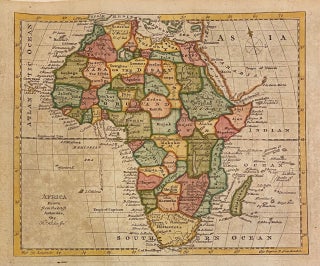
Africa; Drawn from the latest Authorities
London: William Guthrie. Map. Copper plate engraving with modern hand coloring. Image measures 7 1/4 x 8 3/4" Miniature map of the continent of Africa, printed in the 18th century. The map is labeled with cities and rivers, and dotted lines delineate divisions between provinces and kingdoms. The map was published in Guthrie's "A New Geographical, Historical, and Commercial Grammar". It is in very good condition with scattered foxing and minor edge wear. Calligraphy verso in pencil by previous owner..... More