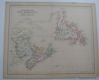
New Foundland, New Brunswick, Nova Scotia Cape Brenton & Prince Edward Is.
1857. Map. Lithograph with hand coloring. Image measures 13.5" x 16.5". Page measures 14.5" x 18". This is a wonderful map of the East Coast of Canada. It includes names of cities, sea ports, bays, and mountains. It is especially unusual considering the level of detail in a map of the region made before the civil war. It was published in 1857. There is some staining and minor chips in the margins as well as a fold at the center..... More