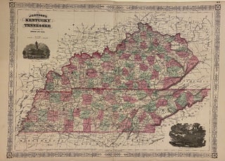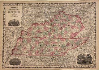
Johnson's Kentucky and Tennessee
New York: Johnson and Browning, 1862. Map. Engraving with original hand coloring. Image measures 17 1/2" x 24". Beautifully colored double-page map of Kentucky and Tennessee. Delineates counties, towns, major routes, waterways and railroads. Includes vignettes "State House Nashville", "Navy Yard Memphis", and "Entrance to the Mammoth Cave". Alvin Jewett Johnson (1827-1884) is one of the most prolific American publishers of the 19th century. He opened his own company in 1856 that produced atlases, maps and encyclopedias. The company made..... More