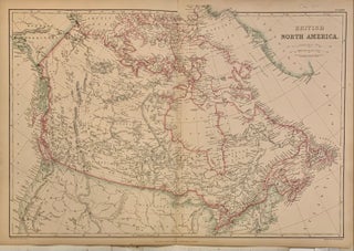
British North America
London: Blackie & Son, 1860. Map. Engraving with original hand coloring. Image measures 13.75" x 19.75". Concise map of Canada when it was a British Colony. Many indigenous names are carefully noted. Slight discoloration along centerfold and small chip to margins. Originally published in the Imperial Atlas of Modern Geography by W. G. Blackie, this map has beautifully hand colored region borders. More