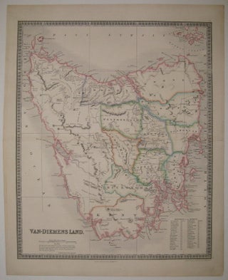
Van-Diemens Land.
London: Henry Teesdale & Co. Map. Engraving with original hand outline color. Image measures 16.25" x 13.25". Beautiful clear double page map of Tasmania divided into counties, circa 1835. Notes extensive geographical features. Topographical elements indicated with hachure marks. A table indicates the original 37 districts. Van Diemen's Land was the original name used by most Europeans for the island of Tasmania, now part of Australia. The name was changed from Van Diemen's Land to Tasmania in 1856. It was..... More